There are a few really magical places (left) on earth. Kasane must be one of them. It is also one of these places where one can get to shoot (with camera only) wildlife real easy and from a different angle, ie from a boat. It is quite easy to do that these days as Kasane is the headquarters of a thriving boat and fishing area for both northern Botswana and the Caprivi region of Namibia. In addition Angola, Zambia and Zimbabwe are all very close as the five coutries almost get together in one point. Four of them almost do it anyway.
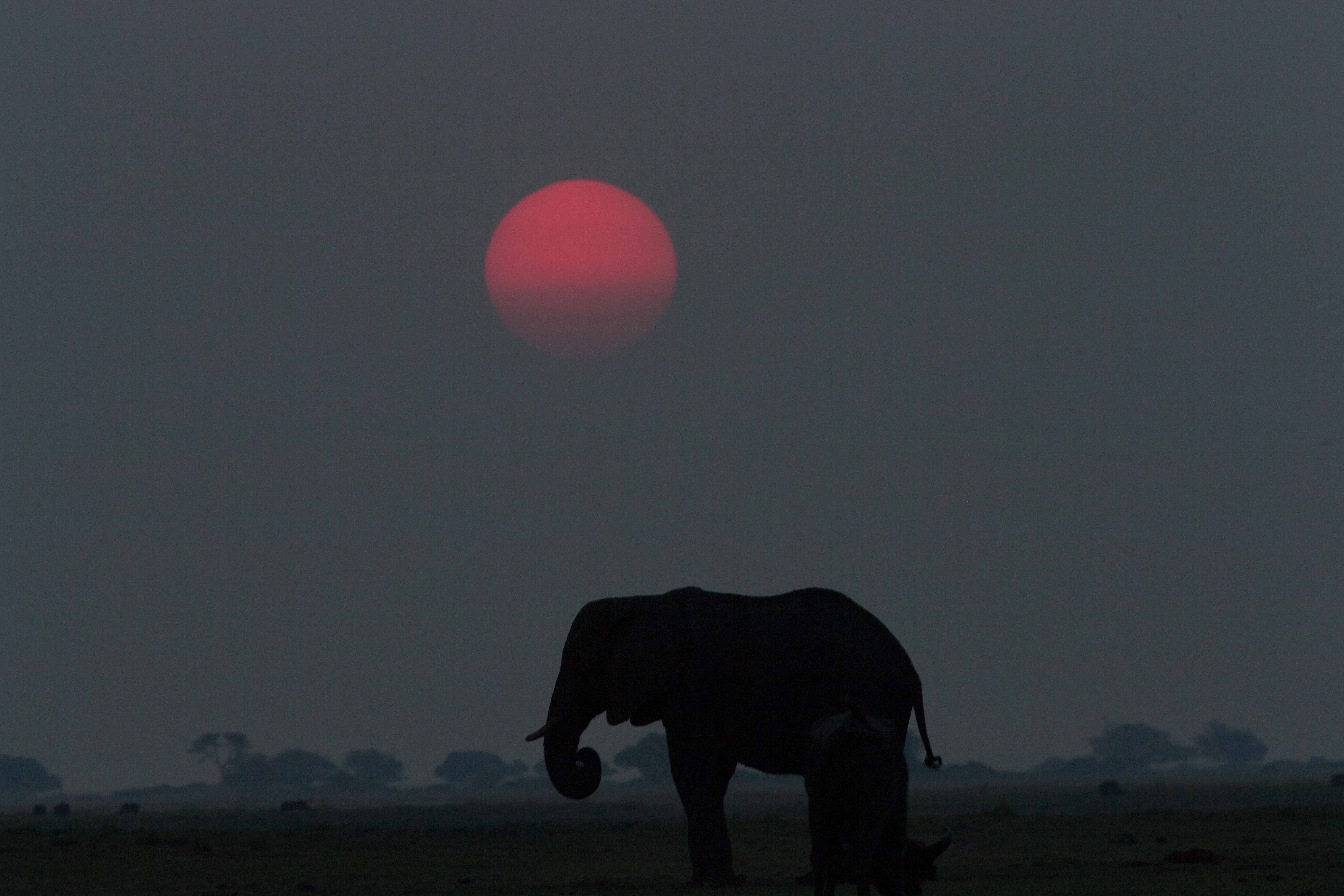
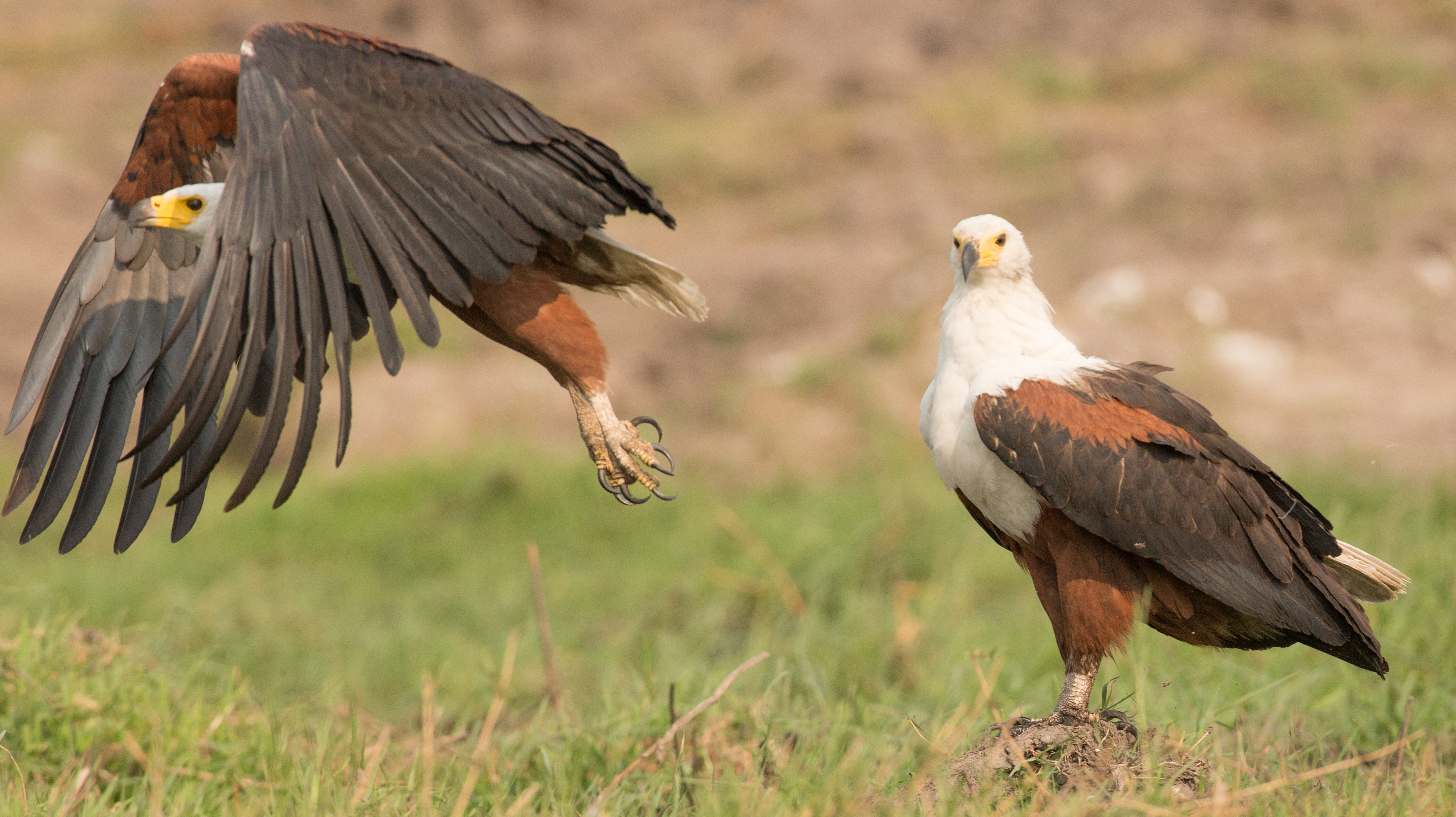
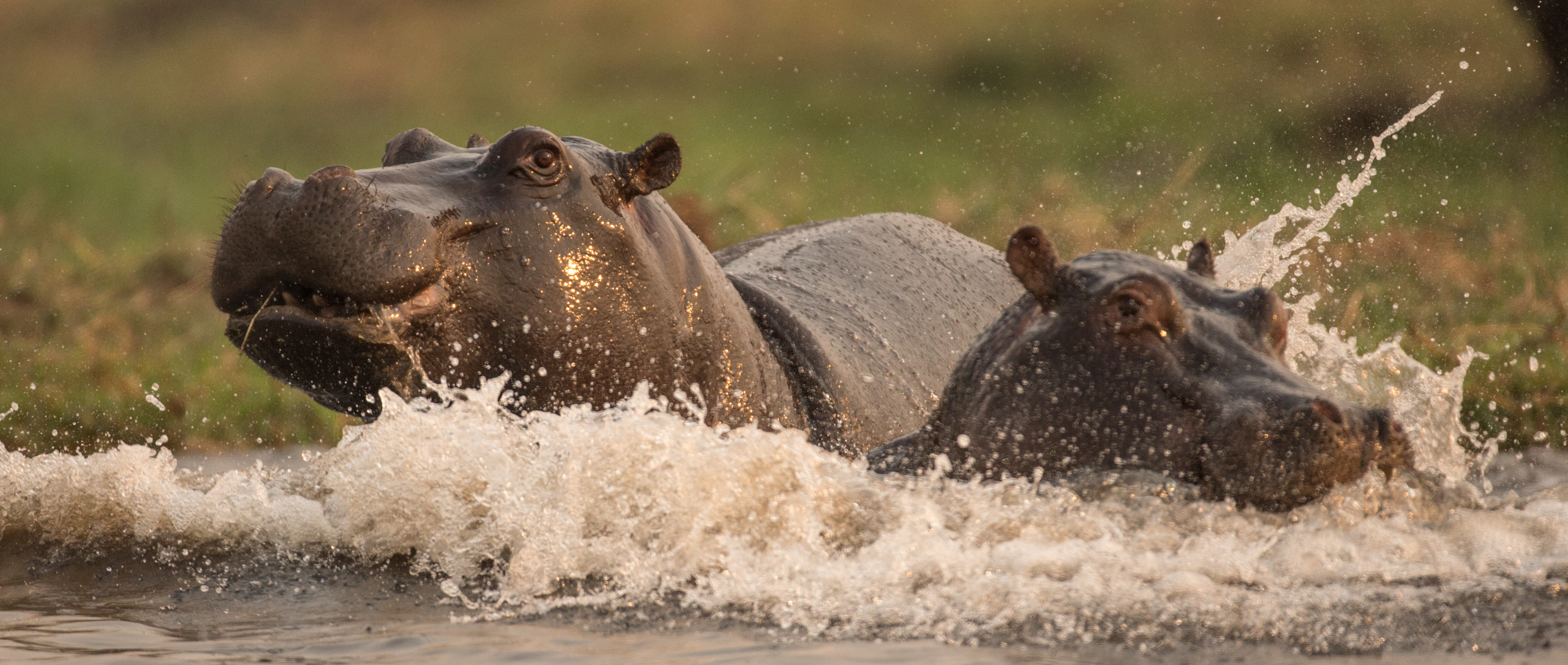
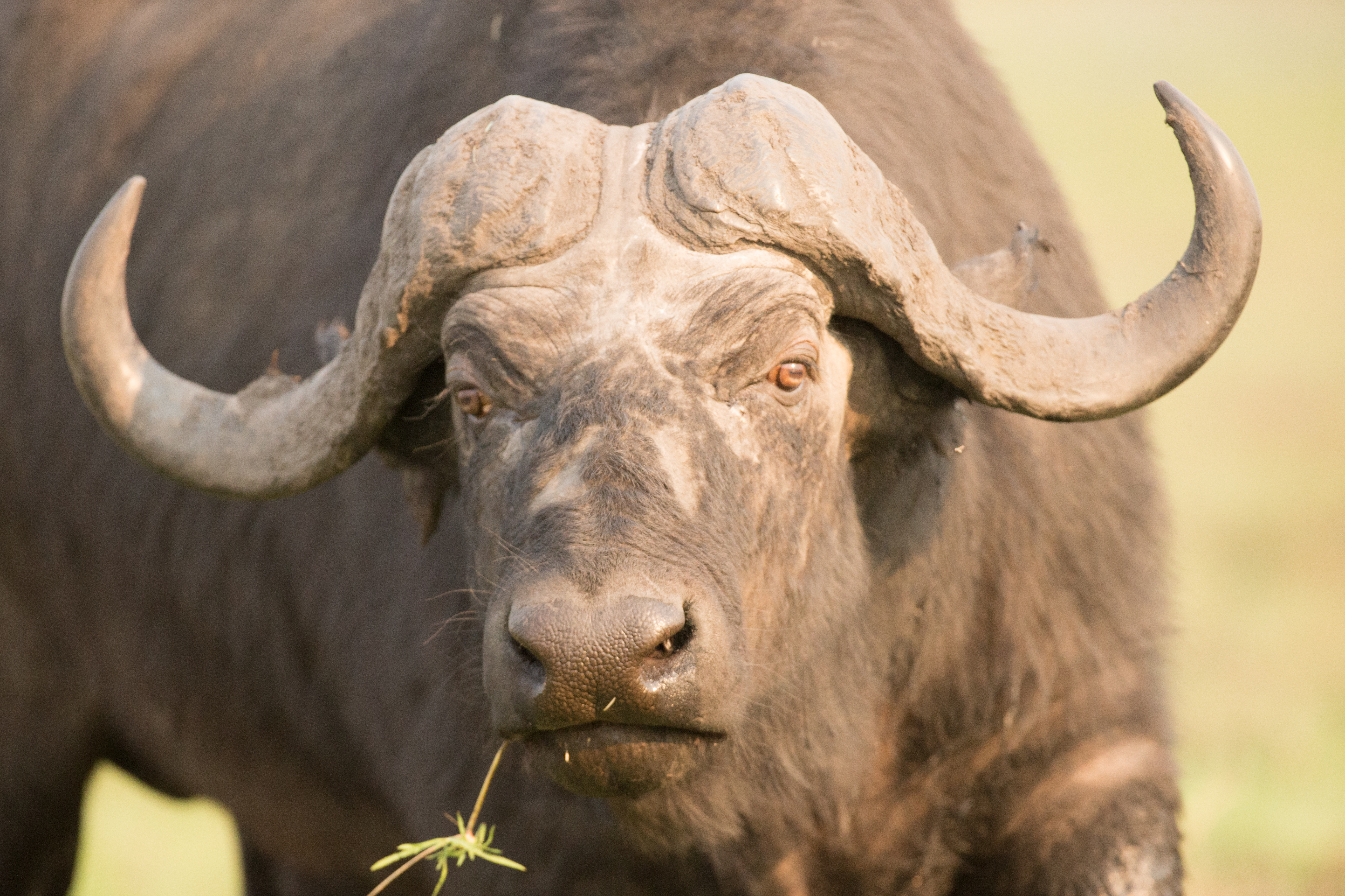
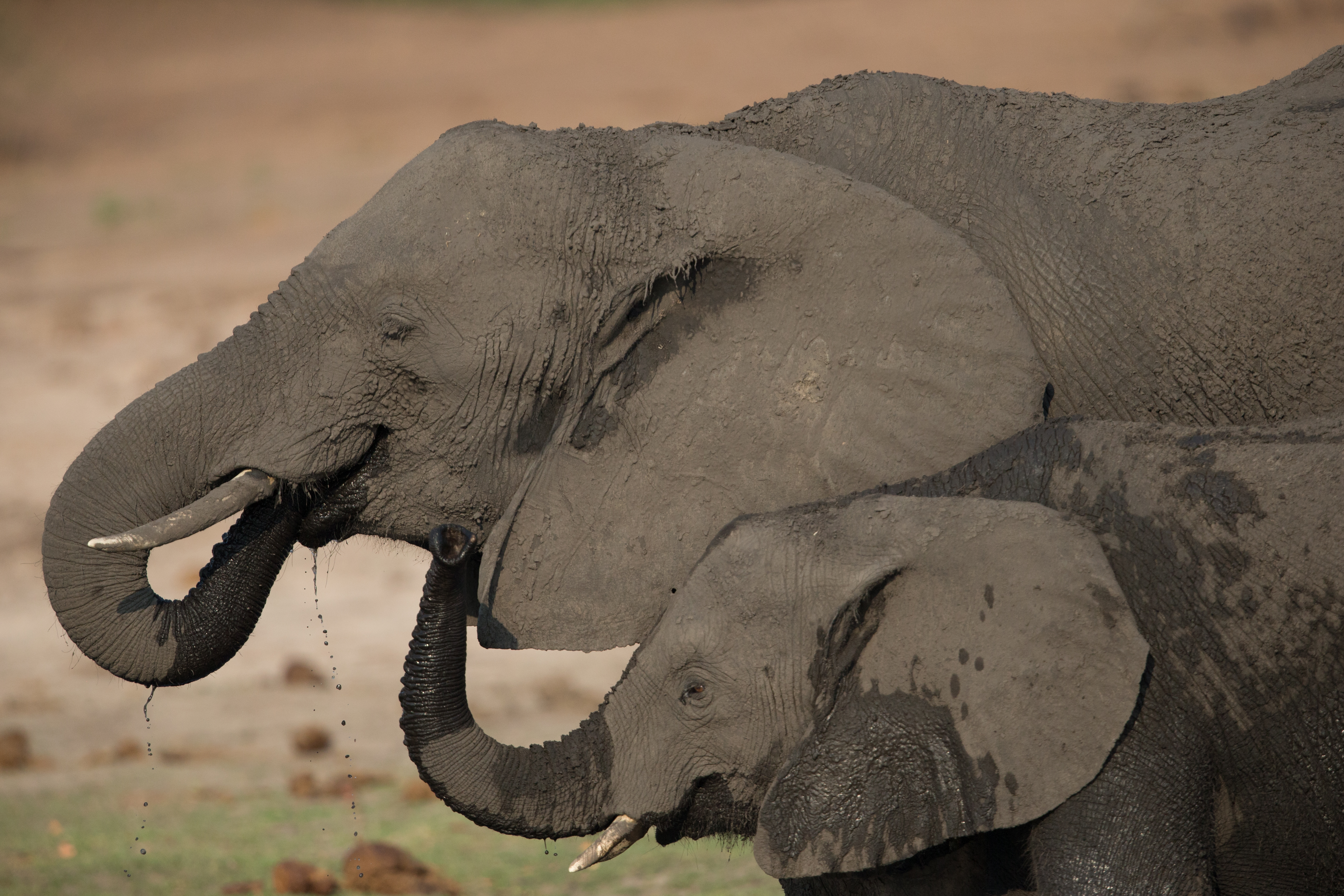
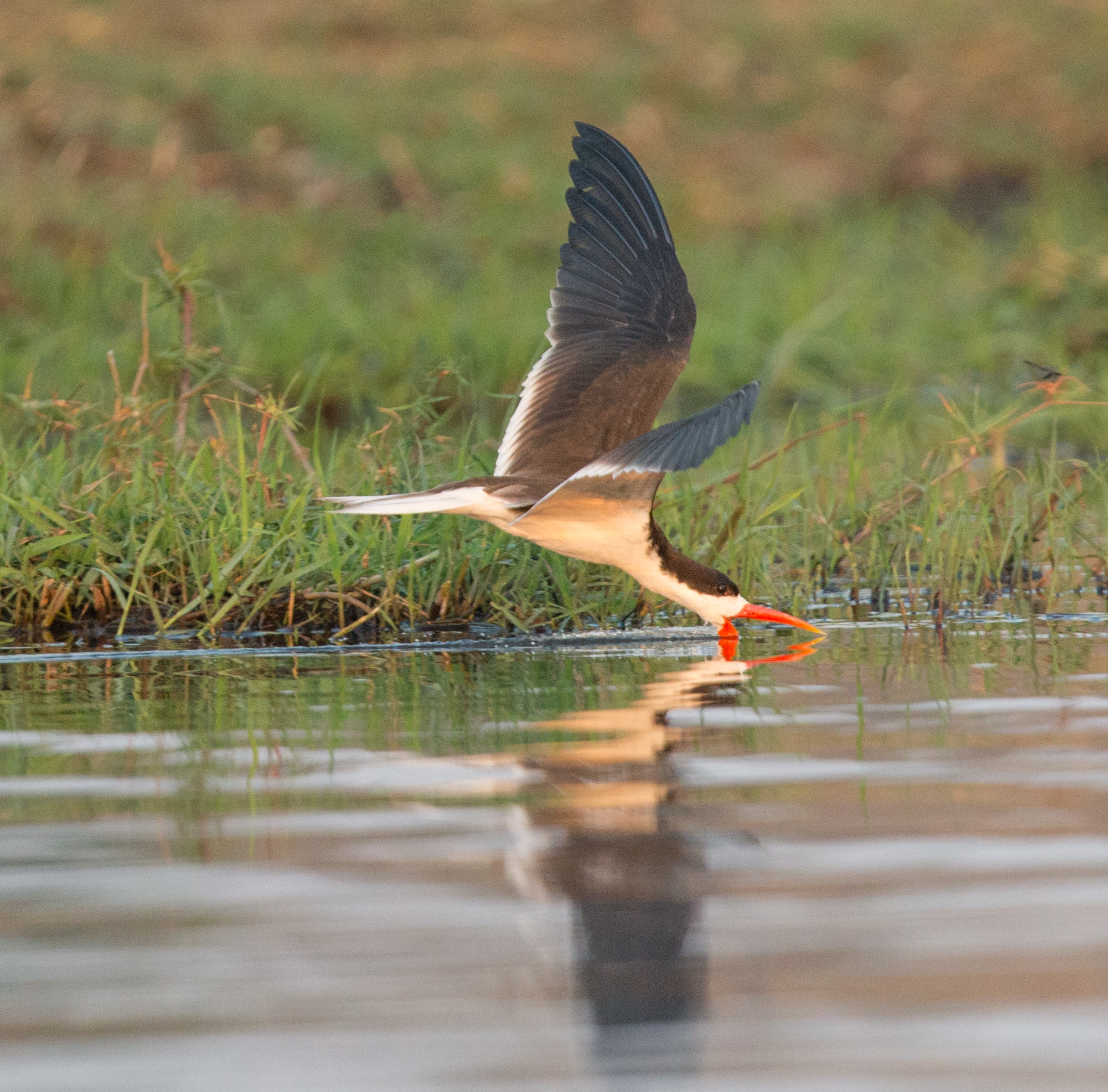
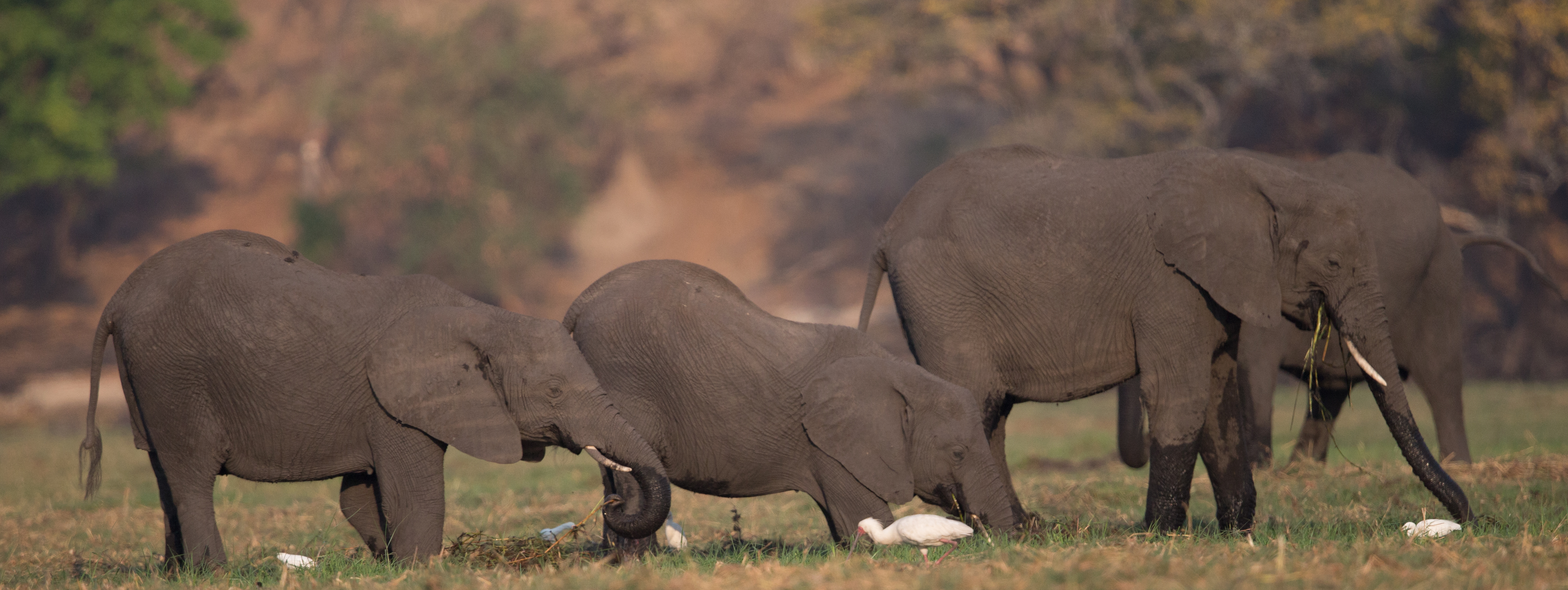
The morning and specially the evenings are magical boat rides where one can encounter large numbers of big game such as elephants, buffalo, and hippo as well a multitude of other animals (crocs, water buck, impala, giraffe, sable) and it is a hot spot for water birds where the mighty fish eagle reigns supreme. There are multitudes of herons, kingfishers, jacana, ducks, skimmers, storks and many more. Did I mention the sunsets, unforgettable! This is where the famous amurula sunset was born my friend.
Sue and I spent a third trip recently in this wonderland and we had six great photo safaris. We were joined by our good friend and fellow photo enthusiast Chris. I share some of my shots below to wet your appetites. Oh , I almost forgot, the Chobe flows into the Zambezi at nearby Kazangula and Kasane is only 80km from Vic falls if you care to visit another of nature’s nearby wonders, eat your hearts out! Some more detailed description about this hotspot below.
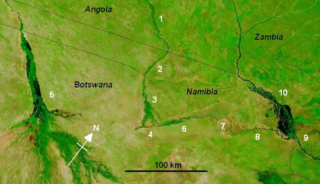
The Cuando rises in the central plateau of Angola on the slopes of Mount Tembo,[3] thence flowing southeast along the Zambian border. Along this reach it flows in a maze of channels in a swampy corridor 5–10 km wide (map 1: the border with Zambia is the eastern bank of this floodplain, not the river channel). As with all rivers in south-central Africa its flow varies enormously between the rainy season when it floods and may be several kilometres wide, and the dry season when it may disappear into marshes.
The Cuando continues in its marshy channel across the neck of the Caprivi Strip of Namibia (map, 2) and then forms the border between Namibia and Botswana as it continues southeast. Some 10,000 years ago, the Cuando merged with the Okavango River and they flowed south to Lake Makgadikgadi (which is a seasonal wetland in current times[4]), but the land in that area was uplifted. As a consequence the Cuando now meets slightly higher ground (map, 4) and breaks up into many channels and swamps (called the Linyanti Swamp) dotted with alluvial islands, nearly disappearing into the Kalahari sands like the Okavango (map, 5). But instead it has diverted east and has been captured by the Zambezi. The flow turns sharply east, still forming the border with Botswana. In the dry season there are few open channels through the swamps and marshes. Beginning at this point it is known as the Linyanti (map, 6), and after it flows through a seasonal lake, Lake Liambesi (map, 7), it is called the Chobe (map, 8). The river then flows into the Zambezi just above the Kazungula Ferry (map, 9).
In years when the Okavango experiences a good flood some of the water escapes east along the normally dry channel of the Magwekwana River into the Linyanti Swamp, thus entering the Zambezi basin. Otherwise the Okavango basin has no outlet.
On the north side of the Chobe River are the Caprivi Swamps, on the edge of which is the ruined capital of the Kololo people who conquered Barotseland in the 19th Century.
So much of the water of the Cuando, Linyanti and Chobe is lost to evaporation in the various swamps that its contribution to the flow of the Zambezi is very small except in occasional years when it floods excessively.